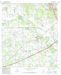
1991 Map of Macdona
USGS Topo · Published 1992About this map
The Medina River meanders through this southwest Bexar County landscape, serving as a geographic anchor for the communities of Macdona and Von Ormy. In the early 1990s, the area maintained a distinct balance between its agricultural roots and military presence, dominated in the northeast by the Lackland Air Force Base Training Annex. This map is particularly valuable for genealogists, as it identifies several small family or community burial grounds, including Arnold Cem, Tripp Cem, and San Isidro Cem, often situated near early ranch holdings like Luckey Ranch and Rio Vista Farms.
Find a feature on this map
68 named features on this map. Tap any name to fly to it.
Don’t see what you’re looking for? This feature index may not catch every label — zoom into the map to look around manually.
Map Details
Editions of this 1991 Macdona Map
This is the sole edition of this map. No revisions or reprints were ever made.
Other maps of this area

1942 · Natalia
USGS Topo · 1:62,500

1953 · Culebra Hill
USGS Topo · 1:24,000

1953 · San Antonio West
USGS Topo · 1:24,000

1953 · Terrell Wells
USGS Topo · 1:24,000

1953 · Macdona
USGS Topo · 1:24,000

1954 · San Antonio
USGS Topo · 1:250,000

1957 · San Antonio
USGS Topo · 1:250,000

1958 · La Coste
USGS Topo · 1:24,000

1958 · Somerset
USGS Topo · 1:24,000

1958 · La Coste NE
USGS Topo · 1:24,000