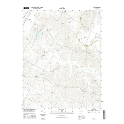
2016 Map of Maceo
USGS Topo · Published 2016About this map
The settlement of Knottsville anchors the southeastern portion of this Kentucky landscape, which is defined by an intricate network of waterways and low-lying basins. Notable drainage features like Pup Cr, Blackford Cr, and the extensive Tywhapity Bottoms dominate the eastern half of the quadrangle, where the boundary between Hancock and Daviess counties follows the winding course of the creek.
Find a feature on this map
85 named features on this map. Tap any name to fly to it.
Don’t see what you’re looking for? This feature index may not catch every label — zoom into the map to look around manually.
Map Details
Editions of this 2016 Maceo Map
This is the sole edition of this map. No revisions or reprints were ever made.
Other maps of this area

1901 · Owensboro
USGS Topo · 1:62,500

1903 · Tell City
USGS Topo · 1:62,500

1906 · Sutherland
USGS Topo · 1:62,500

1907 · Whitesville
USGS Topo · 1:62,500

1909 · Whitesville
USGS Topo · 1:62,500

1952 · Owensboro East
USGS Topo · 1:24,000

1952 · Rockport
USGS Topo · 1:24,000

1953 · Philpot
USGS Topo · 1:24,000

1953 · Sutherland
USGS Topo · 1:24,000

1953 · Lewisport
USGS Topo · 1:24,000