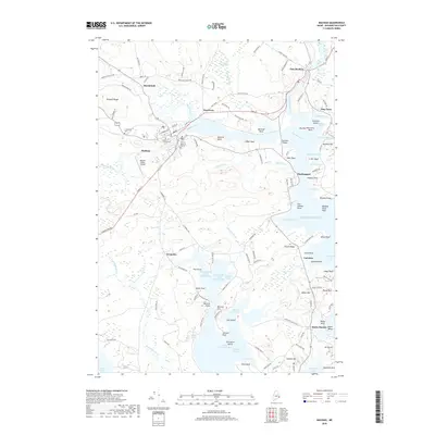
2018 Map of Machias
USGS Topo · Published 2018About this map
Little Kennebec Bay and the estuaries of the Machias River and East Machias River dominate this coastal Washington County landscape. The area is a complex network of peninsulas and coves, including Sanborn Cove, Larrabee Cove, and Shipyard Cove. Higher ground is marked by features like Pumpkin Ridge, Howard Mtn, and Seashore Mtn. Cultural and educational institutions are centered in the larger settlements, notably the Univ of Maine at Machias and the Machias Valley Airport. Genealogists will find several burial grounds mapped, such as Longfellow Cem, Court Street Cem, and O'Brien Cem. The rugged Downeast shoreline is characterized by distinctive points and beaches, from the historic Fort O'Brien Point to the stones of Jasper Beach near Bucks Harbor.
Find a feature on this map
130 named features on this map. Tap any name to fly to it.
Don’t see what you’re looking for? This feature index may not catch every label — zoom into the map to look around manually.
Map Details
Editions of this 2018 Machias Map
This is the sole edition of this map. No revisions or reprints were ever made.
Other maps of this area

1918 · Machias
USGS Topo · 1:62,500

1921 · Columbia Falls
USGS Topo · 1:62,500

1941 · Columbia Falls
USGS Topo · 1:62,500

1941 · Machias
USGS Topo · 1:62,500

1941 · Wesley
USGS Topo · 1:62,500

1941 · Gardner Lake
USGS Topo · 1:62,500

1942 · Columbia Falls
USGS Topo · 1:62,500

1943 · Wesley
USGS Topo · 1:62,500

1943 · Gardner Lake
USGS Topo · 1:62,500

1948 · Jonesport
USGS Topo · 1:24,000