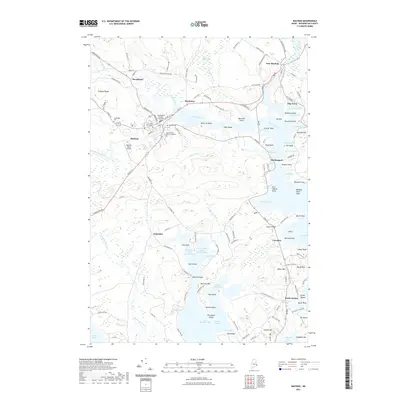
2021 Map of Machias
USGS Topo · Published 2021About this map
The Washington County Courthouse serves as a focal point for the shire town of Machias, where the Machias River meets tidal waters. This coastal landscape is defined by the intricate finger-like inlets of Little Kennebec Bay and the Englishman River, creating a complex network of peninsulas and points. To the east, the settlement of East Machias sits along its namesake river, while coastal outposts like Machiasport and Bucks Harbor anchor the maritime economy. Educational and civic history is reflected in the presence of the University of Maine at Machias and historic burial grounds like Longfellow Cem and Court Street Cem. The terrain rises from the tidal Randall Point Flats to prominent elevations such as Miller Mtn and Seashore Mtn, illustrating the transition from sea-level marsh to the upland ridges of Pumpkin Ridge.
Find a feature on this map
138 named features on this map. Tap any name to fly to it.
Don’t see what you’re looking for? This feature index may not catch every label — zoom into the map to look around manually.
Map Details
Editions of this 2021 Machias Map
This is the sole edition of this map. No revisions or reprints were ever made.
Other maps of this area

1918 · Machias
USGS Topo · 1:62,500

1921 · Columbia Falls
USGS Topo · 1:62,500

1941 · Columbia Falls
USGS Topo · 1:62,500

1941 · Machias
USGS Topo · 1:62,500

1941 · Wesley
USGS Topo · 1:62,500

1941 · Gardner Lake
USGS Topo · 1:62,500

1942 · Columbia Falls
USGS Topo · 1:62,500

1943 · Wesley
USGS Topo · 1:62,500

1943 · Gardner Lake
USGS Topo · 1:62,500

1948 · Jonesport
USGS Topo · 1:24,000