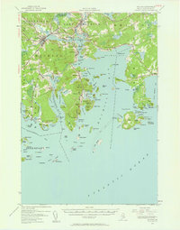
1941 Map of Machias
USGS Topo · Published 1961About this map
Machias sits at the confluence of the Middle River and the Machias River, serving as a central hub for the coastal communities of Washington County during the early 1940s. The landscape is defined by its deep maritime connections, with numerous small harbors and coves like Bucks Harbor and Starboard Cove providing shelter along a fragmented shoreline. Smaller inland settlements such as Dog Town, Hoyttown, and Sylvan Park appear alongside the rail infrastructure at Machiasport Sta, illustrating the connection between the interior woodlands and the sea.
Find a feature on this map
151 named features on this map. Tap any name to fly to it.
Don’t see what you’re looking for? This feature index may not catch every label — zoom into the map to look around manually.
Map Details
Editions of this 1941 Machias Map
Other maps of this area

1907 · Eastport
USGS Topo · 1:48,000

1908 · Eastport
USGS Topo · 1:62,500

1917 · Cutler
USGS Topo · 1:62,500

1918 · Machias
USGS Topo · 1:62,500

1918 · Cutler
USGS Topo · 1:62,500

1921 · Great Wass Island
USGS Topo · 1:62,500

1921 · Columbia Falls
USGS Topo · 1:62,500

1941 · Columbia Falls
USGS Topo · 1:62,500

1941 · Machias
USGS Topo · 1:62,500

1941 · Wesley
USGS Topo · 1:62,500