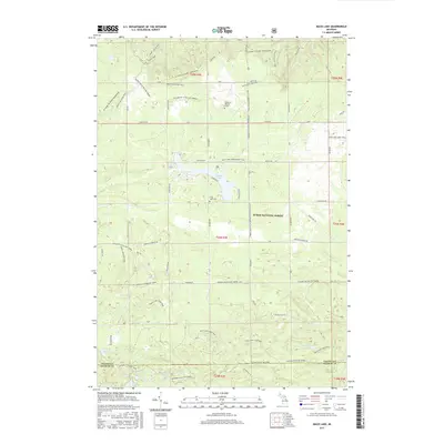
2017 Map of Mack Lake
USGS Topo · Published 2017About this map
Huron National Forest covers much of this landscape in the northern Lower Peninsula, where a complex network of recreational trails and forest roads defines the terrain. The presence of the Lincoln B Watson Grave and the Long Lake Cem provides specific points of interest for genealogists and local historians tracking early residents. The topography is marked by distinctive elevations like Loud - Leaky Hills and Loud - Valley View, which overlook a series of small, scattered water bodies including Happy Lake, Lost Lake, and Trout Lake. A dense system of paths such as the Mi-Shore to Shore Horse&Hike and the Mack Lake Loop Trail suggests a region heavily utilized for outdoor transit and forestry management, while the boundary of Oscoda Co Ogemaw Co runs through the southern portion of the survey.
Find a feature on this map
44 named features on this map. Tap any name to fly to it.
Don’t see what you’re looking for? This feature index may not catch every label — zoom into the map to look around manually.
Map Details
Editions of this 2017 Mack Lake Map
This is the sole edition of this map. No revisions or reprints were ever made.
Other maps of this area

1954 · Traverse City
USGS Topo · 1:250,000

1954 · Tawas City
USGS Topo · 1:250,000

1958 · Traverse City
USGS Topo · 1:250,000

1958 · Tawas City
USGS Topo · 1:250,000

1965 · Damon
USGS Topo · 1:24,000

1965 · Rose City
USGS Topo · 1:24,000

1968 · South Branch
USGS Topo · 1:24,000

1972 · McKinley
USGS Topo · 1:24,000

1972 · Goodar
USGS Topo · 1:24,000

1972 · Mio
USGS Topo · 1:24,000