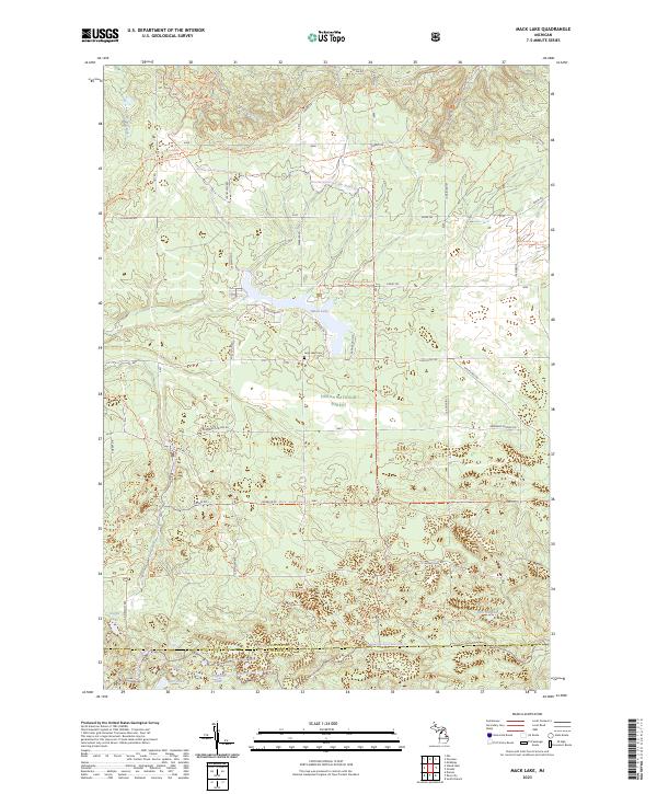
2023 Map of Mack Lake
USGS Topo · Published 2023About this map
The Huron National Forest dominates this section of the northern Michigan landscape, where the boundary between Oscoda and Ogemaw Counties crosses a terrain defined by numerous glacial kettle lakes. Central to the area is Mack Lake, which is surrounded by a network of recreational and service routes including the Mack Lake Loop Trl and Warbler Rd. The presence of the Long Lake Cem near the lake's southern shore provides a specific point of interest for genealogists and local historians researching families from the surrounding townships.
Find a feature on this map
52 named features on this map. Tap any name to fly to it.
Don’t see what you’re looking for? This feature index may not catch every label — zoom into the map to look around manually.
Map Details
Editions of this 2023 Mack Lake Map
This is the sole edition of this map. No revisions or reprints were ever made.
Other maps of this area

1954 · Traverse City
USGS Topo · 1:250,000

1954 · Tawas City
USGS Topo · 1:250,000

1958 · Traverse City
USGS Topo · 1:250,000

1958 · Tawas City
USGS Topo · 1:250,000

1965 · Damon
USGS Topo · 1:24,000

1965 · Rose City
USGS Topo · 1:24,000

1968 · South Branch
USGS Topo · 1:24,000

1972 · McKinley
USGS Topo · 1:24,000

1972 · Goodar
USGS Topo · 1:24,000

1972 · Mio
USGS Topo · 1:24,000