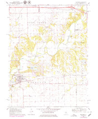
1970 Map of Mackinaw
USGS Topo · Published 1979About this map
The Mackinaw River carves a winding path through the heart of the Mackinaw township, creating a landscape defined by sharp bluffs and rich bottomlands. In the early 1970s, the village of Mackinaw stands as a primary hub, intersected by the Penn Central and Illinois Central railroads. The map reveals the area's rural social fabric through its numerous family and community landmarks, such as the Oak Knoll Sanatorium and several historic burial grounds including Hardscrabble Cem and Bacon Cem. North of the river, the township of Deer Creek is characterized by its agricultural grid and smaller watercourses like Mud Creek. To the east, the landscape transitions toward the Tazewell and McLean county line, where the development of Spin Lake and Posey Ridge Lakes indicates the era's shift toward recreational land use amidst the traditional farming and gravel mining operations.
Find a feature on this map
47 named features on this map. Tap any name to fly to it.
Don’t see what you’re looking for? This feature index may not catch every label — zoom into the map to look around manually.
Map Details
Editions of this 1970 Mackinaw Map
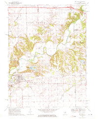
2 editions found
Other maps of this area

1927 · Danvers
USGS Topo · 1:62,500

1928 · Mackinaw
USGS Topo · 1:62,500

1930 · Danvers
USGS Topo · 1:62,500

1932 · Mackinaw
USGS Topo · 1:62,500

1949 · Mc Lean
USGS Topo · 1:62,500

1951 · McLean
USGS Topo · 1:62,500

1951 · Minier
USGS Topo · 1:62,500

1958 · Peoria
USGS Topo · 1:250,000

1961 · Peoria
USGS Topo · 1:250,000

1963 · Peoria
USGS Topo · 1:250,000