Loading...
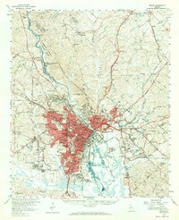
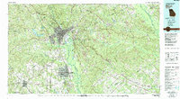
Loading map...1956 Map of Macon
USGS Topo · Published 1970About this map
Macon serves as a dense industrial and educational hub in this mid-century survey, defined by its complex network of railroads including the Southern, Central of Georgia, and the Macon Dublin & Savannah. The city’s cultural and civic landscape is anchored by institutions like Mercer University, Wesleyan College, and the Georgia Academy for the Blind. To the north, the Piedmont National Wildlife Refuge preserves the river corridor near Popes Ferry.
Find a feature on this map
149 named features on this map. Tap any name to fly to it.
Don’t see what you’re looking for? This feature index may not catch every label — zoom into the map to look around manually.
Map Details
Date Portrayed1956
Date Published1970
PublisherU.S. Geological Survey
Map TypeTopographic
Scale1:62,500
Physical Dimensions16.8 x 20.7 inches
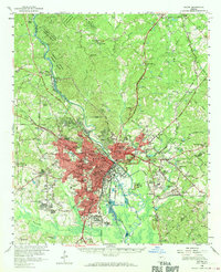
Editions of this 1956 Macon Map
3 editions found
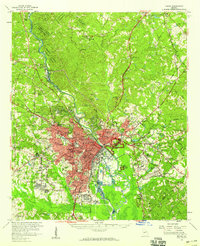
Historical Maps of Macon Through Time
6 maps found


Featured Locations
Source Details
SourceU.S. Geological Survey
CopyrightPublic Domain