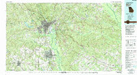
1978 Map of Macon
USGS Topo · Published 1988About this map
The Ocmulgee River corridor anchor this mid-state Georgia landscape, revealing the complex industrial and military geography of the late 1970s. Urban expansion radiates from Macon toward Warner Robins, where the footprint of Robins Air Force Base dominates the southern landscape. The map captures a high degree of aviation activity, noting facilities ranging from the Herbert Smart Airport to the Warner Robins Airpark.
Find a feature on this map
100 named features on this map. Tap any name to fly to it.
Don’t see what you’re looking for? This feature index may not catch every label — zoom into the map to look around manually.
Map Details
Editions of this 1978 Macon Map
2 editions found
Other maps of this area

1912 · Milledgeville
USGS Topo · 1:62,500

1916 · Irwinton
USGS Topo · 1:62,500

1920 · Irwinton
USGS Topo · 1:62,500

1951 · Yatesville
USGS Topo · 1:62,500

1951 · Forsyth
USGS Topo · 1:62,500

1951 · Barnesville
USGS Topo · 1:62,500

1953 · Atlanta
USGS Topo · 1:250,000

1953 · Athens
USGS Topo · 1:250,000

1955 · Phenix City
USGS Topo · 1:250,000

1956 · Fort Valley
USGS Topo · 1:62,500