
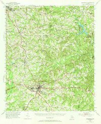
1951 Map of Barnesville
USGS Topo · Published 1953About this map
Barnesville and the industrial village of Aldora serve as the hub of this mid-century Georgia survey, where the Gordon Military College and a local Golf Course reflect the social and educational landscape of the era. The region is defined by its transit networks, notably the Central of Georgia and Southern railroads, alongside the storied Dixie Highway. These routes connect a series of small agricultural and railway settlements such as Goggins, Milner, and Orchard Hill.
Find a feature on this map
106 named features on this map. Tap any name to fly to it.
Don’t see what you’re looking for? This feature index may not catch every label — zoom into the map to look around manually.
Map Details
Editions of this 1951 Barnesville Map
2 editions found
Other maps of this area

1935 · Thomaston
USGS Topo · 1:48,000

1939 · Thomaston
USGS Topo · 1:62,500

1951 · Yatesville
USGS Topo · 1:62,500

1951 · Forsyth
USGS Topo · 1:62,500

1953 · Atlanta
USGS Topo · 1:250,000

1953 · Athens
USGS Topo · 1:250,000

1955 · Phenix City
USGS Topo · 1:250,000

1956 · Bolingbroke
USGS Topo · 1:62,500

1957 · Phenix City
USGS Topo · 1:250,000

1957 · Macon
USGS Topo · 1:250,000