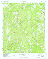
1973 Map of Macon NE
USGS Topo · Published 1977About this map
Clinton and Gray anchor the northern landscape of this Jones County region during the early 1970s, where the rural terrain begins to transition into the urban reach of Macon at the southern edge. The Central of Georgia railroad cuts through the eastern hills, passing the small settlement at Morton and the industrial activity near a local Quarry. This era of the Piedmont landscape shows a significant concentration of family and community heritage sites, including the Henderson-Stripling Cem and Moore Cem, alongside landmarks of local education like the Mattie Wells Sch. Water features such as Rock Creek and the Walnut Creek drainage define the topography, while recreational and memorial spaces like Camp Joycliff and the Middle Georgia Memorial Gardens reflect the evolving land use as the suburbs of Macon expanded northward.
Find a feature on this map
48 named features on this map. Tap any name to fly to it.
Don’t see what you’re looking for? This feature index may not catch every label — zoom into the map to look around manually.
Map Details
Editions of this 1973 Macon NE Map
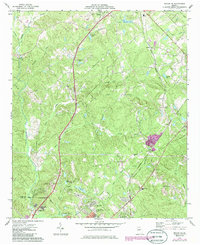
2 editions found
Other maps of this area

1953 · Athens
USGS Topo · 1:250,000

1956 · Gordon
USGS Topo · 1:62,500

1956 · Macon West
USGS Topo · 1:24,000

1956 · Macon East
USGS Topo · 1:24,000

1956 · Macon
USGS Topo · 1:62,500

1957 · Macon
USGS Topo · 1:250,000

1958 · Macon
USGS Topo · 1:250,000

1958 · Athens
USGS Topo · 1:250,000

1959 · Athens
USGS Topo · 1:250,000

1963 · Athens
USGS Topo · 1:250,000