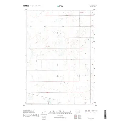
2017 Map of Macs Corner
USGS Topo · Published 2017About this map
Macs Corner serves as a central reference point in this Hyde County landscape, situated at the junction of Co Rd 776 and 337th Ave. The terrain is defined by the drainage patterns of the W Fork Elm Cr and the presence of Lake Ambrose near the southern boundary, where Chieftain Rd connects local homesteads. The map illustrates a strictly organized section-line road system, including Co Rd 961 and numerous numbered avenues like 335th Ave, which partition the prairie into a distinct grid of agricultural tracts. This 2017 survey reflects the persistent rural character of the Fort Thompson District, showing how modern infrastructure follows the historical township and range lines established over a century ago.
Find a feature on this map
24 named features on this map. Tap any name to fly to it.
Don’t see what you’re looking for? This feature index may not catch every label — zoom into the map to look around manually.
Map Details
Editions of this 2017 Macs Corner Map
This is the sole edition of this map. No revisions or reprints were ever made.
Other maps of this area

1953 · Huron
USGS Topo · 1:250,000

1954 · Huron
USGS Topo · 1:250,000

1966 · Big Bend Dam NE
USGS Topo · 1:24,000

1966 · Stephan
USGS Topo · 1:24,000

1966 · Lower Brule NE
USGS Topo · 1:24,000

1973 · Chapelle Lake SE
USGS Topo · 1:24,000

1973 · Macs Corner NE
USGS Topo · 1:24,000

1973 · Macs Corner SE
USGS Topo · 1:24,000

1973 · Chapelle Lake
USGS Topo · 1:24,000

1973 · Macs Corner
USGS Topo · 1:24,000
Featured Places
- Mac's Corner, Fort Thompson District
- Fort Thompson District, SD
- Hyde County, SD
- United States
- South Dakota