
1973 Map of Chapelle Lake SE
USGS Topo · Published 1976About this map
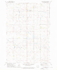
The Crow Creek Indian Reservation Boundary cuts across the southern portion of this landscape, marking a clear division in land use and surveyor focus during the mid-1970s. The settlement of Stephan serves as the primary hub in this prairie region, situated just north of several documented benchmarks. Waterways like South Chapelle Creek, Rush Creek, and the W Fk Elm Cr provide the primary drainage for the undulating terrain. Local infrastructure is sparse but notable, featuring the Pratt Sch and a distinctive Radio Tower BM 2046 near the reservation line. This survey captures the rural character of Hyde County before major modern developments, documenting the precise locations of numerous brass benchmarks and the intersection of township boundaries like Eagle, Pratt, and Dewey.
Find a feature on this map
17 named features on this map. Tap any name to fly to it.
Don’t see what you’re looking for? This feature index may not catch every label — zoom into the map to look around manually.
Map Details
Editions of this 1973 Chapelle Lake SE Map
This is the sole edition of this map. No revisions or reprints were ever made.
Other maps of this area

1953 · Huron
USGS Topo · 1:250,000

1954 · Huron
USGS Topo · 1:250,000

1966 · Lower Brule NW
USGS Topo · 1:24,000

1966 · Stephan
USGS Topo · 1:24,000

1966 · Lower Brule NE
USGS Topo · 1:24,000

1973 · Chapelle Lake SW
USGS Topo · 1:24,000

1973 · Chapelle Lake
USGS Topo · 1:24,000

1973 · Macs Corner
USGS Topo · 1:24,000
1973 · Macs Corner NW
USGS Topo · 1:24,000
1973 · Chapelle Lake NW
USGS Topo · 1:24,000