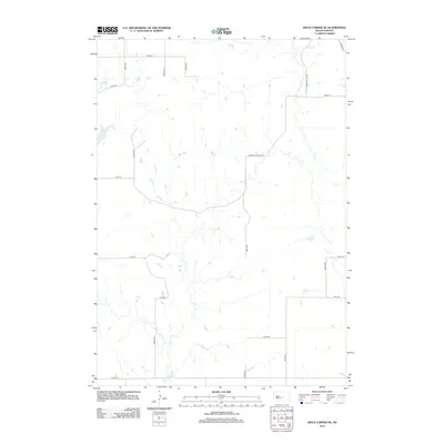
2012 Map of Macs Corner SE
USGS Topo · Published 2012About this map
Elm Cr meanders through this section of Hand County, defining the drainage patterns of an open prairie landscape dominated by a strictly regulated section-line road grid. The map captures the rural character of the region in the early 21st century, where large-scale agricultural activity is supported by a network of gravel and dirt routes such as Lawler Rd and Green Valley Rd. The scarcity of named landmarks highlights the expansive nature of the South Dakota plains, where the intersections of roads like 341st Ave and 208th St serve as the primary navigational markers for residents and land managers. This survey is particularly useful for understanding modern land use and drainage in a part of the state where water courses like the Elm Cr are the most significant natural interruptions to the human-imposed geometry of the township and range system.
Find a feature on this map
16 named features on this map. Tap any name to fly to it.
Don’t see what you’re looking for? This feature index may not catch every label — zoom into the map to look around manually.
Map Details
Editions of this 2012 Macs Corner SE Map
This is the sole edition of this map. No revisions or reprints were ever made.
Other maps of this area

1953 · Huron
USGS Topo · 1:250,000

1954 · Huron
USGS Topo · 1:250,000

1966 · Big Bend Dam NE
USGS Topo · 1:24,000

1966 · Stephan
USGS Topo · 1:24,000

1973 · Macs Corner NE
USGS Topo · 1:24,000

1973 · Miller Dale Colony SW
USGS Topo · 1:24,000

1973 · Big Bend Dam 4 NW
USGS Topo · 1:24,000

1973 · Macs Corner SE
USGS Topo · 1:24,000
1973 · Miller Dale Colony NW
USGS Topo · 1:24,000

1973 · Macs Corner
USGS Topo · 1:24,000