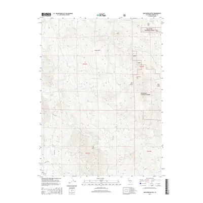
2015 Map of Mad River Buttes
USGS Topo · Published 2015About this map
Six Rivers National Forest land dominates this section of Humboldt County, where the Mad River carves a deep path through the Coast Range. The settlement of Big Bend sits at a prominent turn in the river, serving as a landmark in a landscape defined by significant elevation changes and high ridgelines. High points like Snow Camp Mtn and the Mad River Buttes provide overlook points across the forested drainage basins. Local infrastructure consists primarily of isolated mountain roads, including Jack Shaw Rd and Butte Creek Rd, which navigate the steep terrain between creek systems. Numerous small water bodies such as Snow Camp Lake and Jarnigan Pond are scattered across the high country, while several named peaks like Rooster Rock and Mt Andy break the continuous canopy of the national forest.
Find a feature on this map
37 named features on this map. Tap any name to fly to it.
Don’t see what you’re looking for? This feature index may not catch every label — zoom into the map to look around manually.
Map Details
Editions of this 2015 Mad River Buttes Map
This is the sole edition of this map. No revisions or reprints were ever made.
Other maps of this area

1914 · Pilot Creek
USGS Topo · 1:62,500

1915 · Big Bar and Vicinity
USGS Topo · 1:250,000

1922 · Korbel
USGS Topo · 1:62,500

1922 · China Flat
USGS Topo · 1:62,500

1922 · Kneeland
USGS Topo · 1:62,500

1945 · Blue Lake
USGS Topo · 1:62,500

1950 · Iaqua Buttes
USGS Topo · 1:62,500

1951 · Pilot Creek
USGS Topo · 1:62,500

1951 · Blue Lake
USGS Topo · 1:62,500

1952 · Willow Creek
USGS Topo · 1:62,500