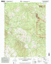
1997 Map of Mad River Buttes
USGS Topo · Published 2001About this map
Mad River carves a deep, winding path through this corner of the Six Rivers National Forest in Humboldt County, California. The landscape is defined by its dramatic verticality, rising from the riverbed to prominent heights such as Rooster Rock, Mount Andy, and the eponymous Mad River Buttes. Human settlement is sparse and utilitarian, represented by small outposts like Three Cabins and working ranch lands including Mt View Ranch and Big Bend Ranch.
Find a feature on this map
41 named features on this map. Tap any name to fly to it.
Don’t see what you’re looking for? This feature index may not catch every label — zoom into the map to look around manually.
Map Details
Editions of this 1997 Mad River Buttes Map
This is the sole edition of this map. No revisions or reprints were ever made.
Other maps of this area

1914 · Pilot Creek
USGS Topo · 1:62,500

1915 · Big Bar and Vicinity
USGS Topo · 1:250,000

1922 · Korbel
USGS Topo · 1:62,500

1922 · China Flat
USGS Topo · 1:62,500

1922 · Kneeland
USGS Topo · 1:62,500

1945 · Blue Lake
USGS Topo · 1:62,500

1950 · Iaqua Buttes
USGS Topo · 1:62,500

1951 · Pilot Creek
USGS Topo · 1:62,500

1951 · Blue Lake
USGS Topo · 1:62,500

1952 · Willow Creek
USGS Topo · 1:62,500