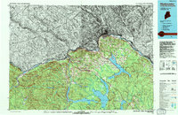
1994 Map of Madawaska
USGS Topo · Published 1994About this map
The St John River forms a winding international boundary through the heart of the Acadian culture of northern Maine, anchoring the commercial centers of Fort Kent and Madawaska. This mid-1990s landscape is defined by the historic corridor of the Bangor and Aroostook railroad and a dense network of Francophone settlements like Violette Settlement, Daigle, and Ouellette. To the south, the Fish River Chain of Lakes—including the expansive Long Lake, Eagle Lake, and Square Lake—dominates the geography, providing a gateway to the deep timberlands of Aroostook County. The map details a transition from the river-valley agriculture and residential clusters near Frenchville to the high ridges of McLean Mtn and Bessy Mountain. Local history and family genealogy are well-represented through numerous named points and coves such as Goddard Cove and Michaud Pt, reflecting generations of land use along the waterways.
Find a feature on this map
73 named features on this map. Tap any name to fly to it.
Don’t see what you’re looking for? This feature index may not catch every label — zoom into the map to look around manually.
Map Details
Editions of this 1994 Madawaska Map
This is the sole edition of this map. No revisions or reprints were ever made.
Other maps of this area

1921 · Van Buren
USGS Topo · 1:250,000

1927 · Stockholm
USGS Topo · 1:48,000

1927 · Square Lake
USGS Topo · 1:48,000

1928 · Eagle Lake
USGS Topo · 1:48,000

1928 · Winterville
USGS Topo · 1:48,000

1929 · Portage
USGS Topo · 1:62,500

1929 · Caribou
USGS Topo · 1:48,000

1930 · Allagash
USGS Topo · 1:48,000

1930 · Fort Fairfield
USGS Topo · 1:48,000

1930 · St Francis
USGS Topo · 1:48,000