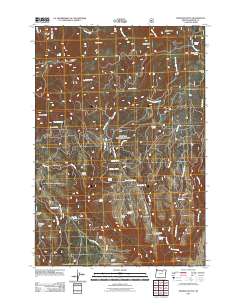
2011 Map of Madison Butte
USGS Topo · Published 2011About this map
Madison Butte dominates this high-elevation landscape within the Umatilla National Forest, serving as a primary landmark in a region defined by dramatic ridges and canyon drainage. The 2011 survey documents the complex network of forest access roads such as Alder Creek Rd and Skookum Spring Rd, which connect remote outposts and ranching operations. Notable among these are the Morphine Ranch near Morphine Ridge and the Circle Bar Ranch located along the upper reaches of Alder Creek.
Find a feature on this map
49 named features on this map. Tap any name to fly to it.
Don’t see what you’re looking for? This feature index may not catch every label — zoom into the map to look around manually.
Map Details
Editions of this 2011 Madison Butte Map
This is the sole edition of this map. No revisions or reprints were ever made.
Other maps of this area

1951 · Monument
USGS Topo · 1:62,500

1953 · Kimberly
USGS Topo · 1:62,500

1953 · Pendleton
USGS Topo · 1:250,000

1955 · Canyon City
USGS Topo · 1:250,000

1956 · Pendleton
USGS Topo · 1:250,000

1959 · Canyon City
USGS Topo · 1:250,000

1969 · Summerfield Ridge
USGS Topo · 1:24,000

1969 · Lake Penland
USGS Topo · 1:24,000

1969 · Arbuckle Mtn
USGS Topo · 1:24,000

1969 · Madison Butte
USGS Topo · 1:24,000