
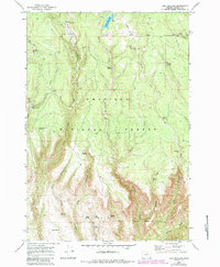
1969 Map of Lake Penland
USGS Topo · Published 1973About this map
Lake Penland sits near the northern boundary of the Umatilla National Forest, serving as a central water feature for this high-elevation landscape in the late 1960s. The topography is defined by the deep incisions of Ditch Creek, Mallory Creek, and Potamus Creek, which carve through the plateau. Evidence of seasonal management and habitation is found at the Ditch Creek Forest Service Station, while remote outposts like Groshen Cabin and McMurdo Cabin are tucked into the drainages.
Find a feature on this map
41 named features on this map. Tap any name to fly to it.
Don’t see what you’re looking for? This feature index may not catch every label — zoom into the map to look around manually.
Map Details
Editions of this 1969 Lake Penland Map
2 editions found
Other maps of this area

1950 · Ritter
USGS Topo · 1:62,500

1951 · Monument
USGS Topo · 1:62,500

1952 · Ritter
USGS Topo · 1:62,500

1953 · Pendleton
USGS Topo · 1:250,000

1955 · Canyon City
USGS Topo · 1:250,000

1956 · Pendleton
USGS Topo · 1:250,000

1959 · Canyon City
USGS Topo · 1:250,000

1969 · Summerfield Ridge
USGS Topo · 1:24,000

1969 · Thompson Flat
USGS Topo · 1:24,000

1969 · Arbuckle Mtn
USGS Topo · 1:24,000