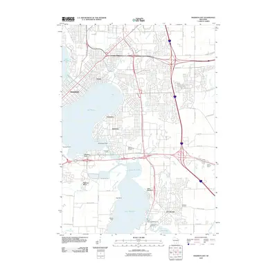
2010 Map of Madison East
USGS Topo · Published 2010About this map
Lake Monona and Lake Waubesa anchor this map of the eastern capital region, illustrating the intense suburban development and infrastructure of the early 21st century. The city of Monona occupies the northern shores, while McFarland sits to the southeast near the Lake Waubesa 2WP290 Dam. The Yahara River system provides the central hydrological spine, connecting the major lakes through marshy basins like Upper Mud Lake.
Find a feature on this map
57 named features on this map. Tap any name to fly to it.
Don’t see what you’re looking for? This feature index may not catch every label — zoom into the map to look around manually.
Map Details
Editions of this 2010 Madison East Map
This is the sole edition of this map. No revisions or reprints were ever made.
Other maps of this area

1889 · Evansville
USGS Topo · 1:62,500

1890 · Madison
USGS Topo · 1:62,500

1890 · Sun Prairie
USGS Topo · 1:62,500

1890 · Stoughton
USGS Topo · 1:62,500

1892 · Madison
USGS Topo · 1:62,500

1894 · Evansville
USGS Topo · 1:62,500

1896 · Sun Prairie
USGS Topo · 1:62,500

1904 · Madison
USGS Topo · 1:62,500

1905 · Sun Prairie
USGS Topo · 1:62,500

1906 · Evansville
USGS Topo · 1:62,500