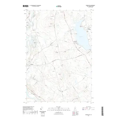
2021 Map of Madison East
USGS Topo · Published 2021About this map
The Kennebec River corridor defines this portion of Somerset County, where the industrial and residential core of Madison transitions into the upland farms and ridges of the interior. The landscape is marked by prominent elevations such as Thurston Hill and Blackwell Hill, which overlook a network of brooks and minor drainages including Pooler Brook and Jones Brook. Significant for local historians is the alignment of the Trolley Line, a reminder of earlier regional transit that once connected these rural communities. To the east, Wesserunsett Lake serves as a major geographical anchor, with the settlement of Lakewood situated along its western shore. For genealogists, the map is particularly useful for its documentation of numerous small burial grounds, including the Blackwell Cem, Morse Cem, and the Danforth Cem, which are scattered throughout the hills and valley floor, often located near old farmstead roads.
Find a feature on this map
87 named features on this map. Tap any name to fly to it.
Don’t see what you’re looking for? This feature index may not catch every label — zoom into the map to look around manually.
Map Details
Editions of this 2021 Madison East Map
This is the sole edition of this map. No revisions or reprints were ever made.
Other maps of this area

1892 · Waterville
USGS Topo · 1:62,500

1894 · Norridgewock
USGS Topo · 1:62,500

1898 · Norridgewock
USGS Topo · 1:62,500

1904 · Anson
USGS Topo · 1:62,500

1913 · Skowhegan
USGS Topo · 1:62,500

1943 · Norridgewock
USGS Topo · 1:62,500

1943 · Waterville
USGS Topo · 1:62,500

1948 · Bangor
USGS Topo · 1:250,000

1955 · Anson
USGS Topo · 1:62,500

1955 · Skowhegan
USGS Topo · 1:62,500