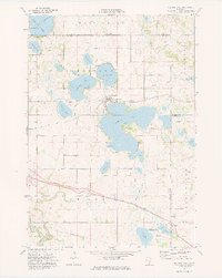
1974 Map of Madison Lake
USGS Topo · Published 1976About this map
The town of Madison Lake sits at the heart of this mid-1970s lake country landscape, positioned between its namesake Madison Lake and the smaller Duck Lake. The region is defined by an intricate network of water bodies, including Ballantyne Lake, Gilfillin Lake, and the eastern reaches of Lake Washington. This survey captures the area as the Chicago and North Western railroad still cut through the southern townships of LeRay and Janesville, while remnants of transportation history are visible in the Old RR Grade passing north of town. Rural life centers around small settlements like Marysburg to the north and Smiths Mill in the southeast, with local landmarks such as Calvary Cem and various public access points providing specific points of interest for local historians. In the southwest, the Le Sueur River carves a winding path toward the Minnesota River valley, contrasting with the still waters and wetlands of the State Wildlife Management Area.
Find a feature on this map
34 named features on this map. Tap any name to fly to it.
Don’t see what you’re looking for? This feature index may not catch every label — zoom into the map to look around manually.
Map Details
Editions of this 1974 Madison Lake Map
This is the sole edition of this map. No revisions or reprints were ever made.
Other maps of this area

1950 · Mankato East
USGS Topo · 1:62,500

1951 · Mankato East
USGS Topo · 1:62,500

1953 · Saint Paul
USGS Topo · 1:250,000

1959 · Saint Paul
USGS Topo · 1:250,000

1965 · Cleveland
USGS Topo · 1:24,000
1965 · St Peter
USGS Topo · 1:24,000

1966 · Janesville
USGS Topo · 1:24,000

1966 · Cordova
USGS Topo · 1:24,000

1966 · Elysian
USGS Topo · 1:24,000
1974 · Mankato East
USGS Topo · 1:24,000