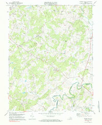
1971 Map of Madison Mills
USGS Topo · Published 1984About this map
The Rapidan River forms a winding border between Madison and Orange Counties in this 1971 survey of central Virginia. The landscape is dotted with small rural crossroads and historical hamlets such as Madison Mills, Aroda, and Radiant. These communities are anchored by a dense network of country houses of worship, including Good Hope Ch, Locust Grove Ch, and Mt Zion Ch, which often serve as the primary landmarks in an area dominated by agricultural drainage patterns like Beautiful Run and Great Run.
Find a feature on this map
40 named features on this map. Tap any name to fly to it.
Don’t see what you’re looking for? This feature index may not catch every label — zoom into the map to look around manually.
Map Details
Editions of this 1971 Madison Mills Map
2 editions found
Other maps of this area

1892 · Gordonsville
USGS Topo · 1:125,000

1930 · Madison
USGS Topo · 1:48,000

1933 · Madison
USGS Topo · 1:62,500

1935 · Charlottesville
USGS Topo · 1:62,500

1939 · Charlottesville
USGS Topo · 1:62,500

1949 · Charlottesville
USGS Topo · 1:250,000

1949 · Charlottesville
USGS Topo · 1:62,500

1956 · Charlottesville
USGS Topo · 1:250,000

1961 · Gordonsville
USGS Topo · 1:62,500

1961 · Rapidan
USGS Topo · 1:62,500