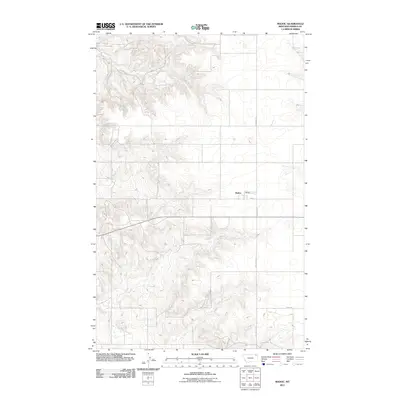
2011 Map of Madoc
USGS Topo · Published 2011About this map
Madoc serves as the central focal point of this sparsely settled landscape in northeastern Montana, captured during the first decade of the 2000s. The settlement pattern is defined by a rigid grid of section-line roads, such as N Madoc Rd and Rowe Rd, which stretch across the high plains of Daniels County. The core of the hamlet is marked by Main St, while the surrounding terrain is etched by seasonal watercourses like the one followed by Line Coulee Rd. This survey reflects the enduring agricultural layout of the region, where infrastructure is minimal and oriented around a few primary transit corridors and small, scattered community hubs typical of the Big Sky country.
Find a feature on this map
5 named features on this map. Tap any name to fly to it.
Don’t see what you’re looking for? This feature index may not catch every label — zoom into the map to look around manually.
Map Details
Editions of this 2011 Madoc Map
This is the sole edition of this map. No revisions or reprints were ever made.
Other maps of this area

1954 · Wolf Point
USGS Topo · 1:250,000

1958 · Wolf Point
USGS Topo · 1:250,000

1973 · Madoc
USGS Topo · 1:24,000

1973 · Flaxville
USGS Topo · 1:24,000

1973 · Whitetail
USGS Topo · 1:24,000

1973 · Line Coulee
USGS Topo · 1:24,000

1973 · Scobey
USGS Topo · 1:24,000

1973 · Pleasant Prairie NW
USGS Topo · 1:24,000

1973 · Scobey NW
USGS Topo · 1:24,000

1973 · Cabarett Coulee
USGS Topo · 1:24,000