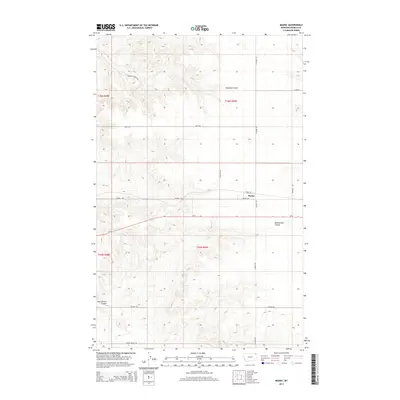
2014 Map of Madoc
USGS Topo · Published 2014About this map
Madoc sits at the intersection of Main St and N Madoc Rd, serving as a central point in this Daniels County landscape. The area is defined by a series of deep drainage features including Shannon Coulee to the north and the winding Manternach Coulee to the south. The road network follows the rigid Public Land Survey System grid, with named routes like Back Rd and Wilson Rd providing access to the vast agricultural sections. A legacy of early 20th-century settlement is visible in the naming of local landmarks such as Shannon Creek Rd and Frenchy's Rd, reflecting the families who established themselves on these plains. The terrain shows the subtle but significant elevation changes characteristic of the northeastern Montana prairie, with Mt-5 cutting west-to-east through the center of the township.
Find a feature on this map
22 named features on this map. Tap any name to fly to it.
Don’t see what you’re looking for? This feature index may not catch every label — zoom into the map to look around manually.
Map Details
Editions of this 2014 Madoc Map
This is the sole edition of this map. No revisions or reprints were ever made.
Other maps of this area

1954 · Wolf Point
USGS Topo · 1:250,000

1958 · Wolf Point
USGS Topo · 1:250,000

1973 · Madoc
USGS Topo · 1:24,000

1973 · Flaxville
USGS Topo · 1:24,000

1973 · Whitetail
USGS Topo · 1:24,000

1973 · Line Coulee
USGS Topo · 1:24,000

1973 · Scobey
USGS Topo · 1:24,000

1973 · Pleasant Prairie NW
USGS Topo · 1:24,000

1973 · Scobey NW
USGS Topo · 1:24,000

1973 · Cabarett Coulee
USGS Topo · 1:24,000