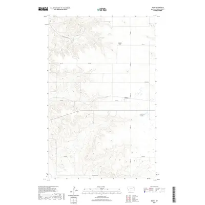
2020 Map of Madoc
USGS Topo · Published 2020About this map
Madoc sits at the intersection of several rural arterial routes in this corner of Daniels County, serving as a focal point for the surrounding agricultural plains. The landscape is defined by the subtle drainage patterns of Shannon Coulee and Manternach Coulee, which cut through the high prairie. This 2020 edition provides a contemporary record of the township and range system, specifically noting the sections within t36n r48e and t36n r49e. The transportation network relies on a grid of named section-line roads, including Spring Valley Rd, Wilson Rd, and Shannen Creek Rd, which link isolated ranching and farming operations to the small settlement at Madoc. The map captures the persistence of these named rural corridors in a region where geography is often dictated by drainage and the long-established land division lines.
Find a feature on this map
19 named features on this map. Tap any name to fly to it.
Don’t see what you’re looking for? This feature index may not catch every label — zoom into the map to look around manually.
Map Details
Editions of this 2020 Madoc Map
This is the sole edition of this map. No revisions or reprints were ever made.
Other maps of this area

1954 · Wolf Point
USGS Topo · 1:250,000

1958 · Wolf Point
USGS Topo · 1:250,000

1973 · Madoc
USGS Topo · 1:24,000

1973 · Flaxville
USGS Topo · 1:24,000

1973 · Whitetail
USGS Topo · 1:24,000

1973 · Line Coulee
USGS Topo · 1:24,000

1973 · Scobey
USGS Topo · 1:24,000

1973 · Pleasant Prairie NW
USGS Topo · 1:24,000

1973 · Scobey NW
USGS Topo · 1:24,000

1973 · Cabarett Coulee
USGS Topo · 1:24,000