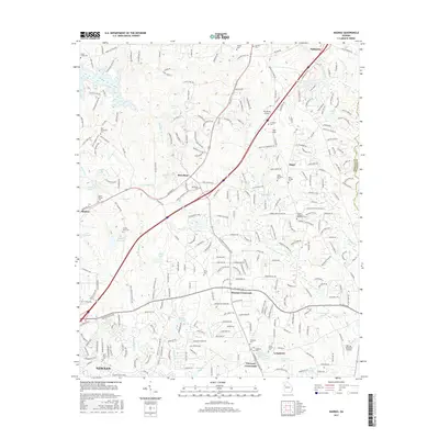
2017 Map of Madras
USGS Topo · Published 2017About this map
Newnan and the northern reaches of Coweta County are defined here by a dense network of crossroads and small settlements during the late 2010s. The landscape is characterized by a high concentration of family and community burial grounds, such as the Powers - Taliaferro - Weatherly Cem and the Arnold - Sims Cem, which offer significant touchpoints for genealogical research. The region's transport patterns are marked by the CSX Transportation rail line and the presence of small-scale aviation at Two Rocks Airport and Rolling Meadows Airfield. Named settlements like McCollum, Thomas Crossroads, and Vineyard Crossroads act as local hubs between numerous private lakes and reservoirs, including Norris Lake and Sullivan Lake. The convergence of rural character with modern development is evident in the transition from family-named landmarks like Andy Fields to organized neighborhoods along Palmetto Tyrone Rd.
Find a feature on this map
285 named features on this map. Tap any name to fly to it.
Don’t see what you’re looking for? This feature index may not catch every label — zoom into the map to look around manually.
Map Details
Editions of this 2017 Madras Map
This is the sole edition of this map. No revisions or reprints were ever made.
Other maps of this area

1891 · Marietta
USGS Topo · 1:125,000

1895 · Marietta
USGS Topo · 1:125,000

1897 · Marietta
USGS Topo · 1:125,000

1901 · Marietta
USGS Topo · 1:125,000

1953 · Atlanta
USGS Topo · 1:250,000

1954 · Palmetto
USGS Topo · 1:24,000

1954 · Fairburn
USGS Topo · 1:24,000

1957 · Atlanta
USGS Topo · 1:250,000

1958 · Rico
USGS Topo · 1:24,000

1958 · Atlanta
USGS Topo · 1:250,000