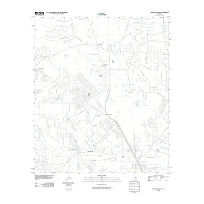
2010 Map of Magnolia East
USGS Topo · Published 2010About this map
Pinehurst and its surrounding communities in Montgomery and Harris Counties appear here during a period of residential expansion and ongoing industrial activity. The landscape is defined by the Pinehurst Gas and Oil Field and a network of minor tributaries like Mill Creek and Dry Creek that feed into the larger Spring Creek system. Long-established local family histories are marked by several burial grounds including Tillis Prairie Cemetery, Goodson Cemetery, and Decker Prairie Cemetery. The layout of the region shows a mix of older rural settlements like Mostyn and Ventura alongside newer developments centered around artificial water bodies such as Lake Apache and Hall Lake. The road network, featuring FM 1488 RD and Magnolia Blvd, illustrates the transition from a traditional timber and oil economy to an increasingly suburban environment.
Find a feature on this map
88 named features on this map. Tap any name to fly to it.
Don’t see what you’re looking for? This feature index may not catch every label — zoom into the map to look around manually.
Map Details
Editions of this 2010 Magnolia East Map
This is the sole edition of this map. No revisions or reprints were ever made.
Other maps of this area

1916 · Rose Hill
USGS Topo · 1:24,000

1916 · Louetta
USGS Topo · 1:24,000

1916 · Hockley
USGS Topo · 1:24,000

1920 · Hockley
USGS Topo · 1:31,680

1920 · Rose Hill
USGS Topo · 1:31,680

1920 · Louetta
USGS Topo · 1:31,680

1954 · Beaumont
USGS Topo · 1:250,000

1957 · Beaumont
USGS Topo · 1:250,000

1958 · Cowl Spur
USGS Topo · 1:24,000

1962 · Keenan
USGS Topo · 1:24,000