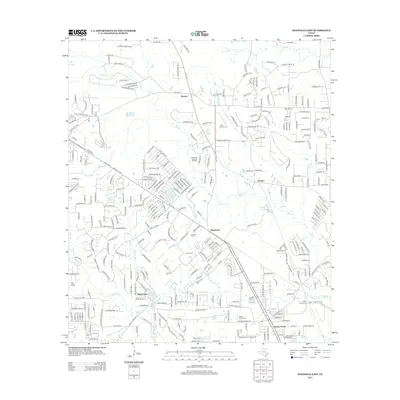
2013 Map of Magnolia East
USGS Topo · Published 2013About this map
Decker Prairie and Pinehurst anchor this portion of the Texas Gulf Coastal Plain, where residential development and industrial activity meet the drainage basins of Mill Cr and Cow Br. The landscape is characterized by a dense network of suburban roads and specialized sites like the Pinehurst Gas and Oil Field, reflecting the region's energy-based economy. Local heritage is preserved in several small burial grounds, including Goodson Cem, Corgey Cem, and the Tills Prairie Cem. Water features are prominent throughout the quadrangle, with Lake Apache, Hall Lake, and Neidigk Lake dotting the terrain. The area's transition from rural prairie to a more structured settlement pattern is evident in the layout of communities such as Stagecoach and Mostyn, showing the continued northward expansion of the greater Houston area during this period.
Find a feature on this map
313 named features on this map. Tap any name to fly to it.
Don’t see what you’re looking for? This feature index may not catch every label — zoom into the map to look around manually.
Map Details
Editions of this 2013 Magnolia East Map
This is the sole edition of this map. No revisions or reprints were ever made.
Other maps of this area

1916 · Rose Hill
USGS Topo · 1:24,000

1916 · Louetta
USGS Topo · 1:24,000

1916 · Hockley
USGS Topo · 1:24,000

1920 · Hockley
USGS Topo · 1:31,680

1920 · Rose Hill
USGS Topo · 1:31,680

1920 · Louetta
USGS Topo · 1:31,680

1954 · Beaumont
USGS Topo · 1:250,000

1957 · Beaumont
USGS Topo · 1:250,000

1958 · Cowl Spur
USGS Topo · 1:24,000

1962 · Keenan
USGS Topo · 1:24,000