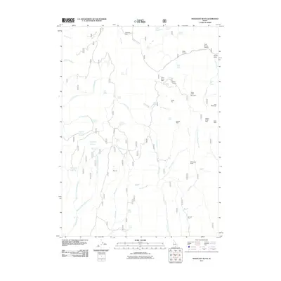
2011 Map of Mahogany Butte
USGS Topo · Published 2011About this map
Mahogany Butte and the surrounding high country of Cassia County are defined by a complex network of springs and drainage systems. This interior landscape relies heavily on water sources such as Thoroughbred Spring Number One, Crystal Spring, and Kidd Spring to support movement through the high-elevation passes. The terrain is marked by distinctive summits including Trout Creek Mountain, Swanty Peak, and the curiously named South Tit and Dads Hump. The presence of the Jay Creek Corral in the southeast corner indicates the ongoing importance of livestock management in these upland basins. A dramatic vertical landscape is revealed through features like the Phantom Falls Waterfall on Fall Creek, while transit across the ridges is funneled through Deerhorn Pass and Trout Creek Pass. This 2011 survey captures the area's transition between isolated peaks and the deep recesses of Joes Basin.
Find a feature on this map
60 named features on this map. Tap any name to fly to it.
Don’t see what you’re looking for? This feature index may not catch every label — zoom into the map to look around manually.
Map Details
Editions of this 2011 Mahogany Butte Map
This is the sole edition of this map. No revisions or reprints were ever made.
Other maps of this area

1955 · Twin Falls
USGS Topo · 1:250,000

1955 · Wells
USGS Topo · 1:250,000

1958 · Wells
USGS Topo · 1:250,000

1958 · Twin Falls
USGS Topo · 1:250,000

1961 · Wells
USGS Topo · 1:250,000

1961 · Gollaher Mountain
USGS Topo · 1:62,500

1961 · Goose Creek
USGS Topo · 1:62,500

1977 · Timber Butte
USGS Topo · 1:24,000

1977 · Mahogany Butte
USGS Topo · 1:24,000
1977 · Ibex Peak
USGS Topo · 1:24,000