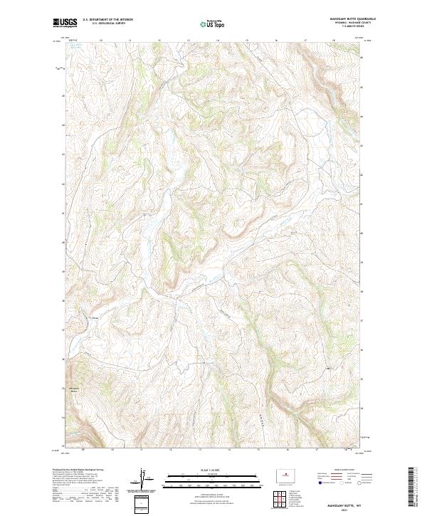
2021 Map of Mahogany Butte
USGS Topo · Published 2021About this map
The Nowood River meanders through this portion of Washakie County, defining a landscape of seasonal drainages and remote upland ridges. The terrain is marked by the prominent Mahogany Butte, a landmark that anchors the southwestern corner of the sheet. This area is characterized by a network of ranch and access roads, such as Upper Nowood Rd and Cherry Creek Rd, which follow the contours of the land between high plateaus and creek bottoms. Water management is evident in the presence of the Need Water Reservoir, suggesting the critical importance of water storage in this arid Wyoming environment.
Find a feature on this map
26 named features on this map. Tap any name to fly to it.
Don’t see what you’re looking for? This feature index may not catch every label — zoom into the map to look around manually.
Map Details
Editions of this 2021 Mahogany Butte Map
This is the sole edition of this map. No revisions or reprints were ever made.
Other maps of this area

1955 · Arminto
USGS Topo · 1:250,000

1958 · Arminto
USGS Topo · 1:250,000

1962 · Arminto
USGS Topo · 1:250,000

1966 · Big Trails
USGS Topo · 1:24,000
1966 · Tallon Spring
USGS Topo · 1:24,000

1966 · Indian Creek
USGS Topo · 1:24,000

1967 · Mahogany Butte
USGS Topo · 1:24,000
1967 · Cornell Gulch
USGS Topo · 1:24,000

1967 · Horse Butte
USGS Topo · 1:24,000
1967 · Lightning Ridge
USGS Topo · 1:24,000