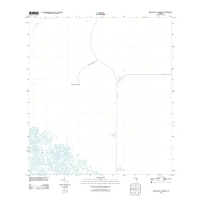
2012 Map of Mahogany Hammock
USGS Topo · Published 2012About this map
Everglades National Park defines this landscape, where the terrestrial environment meets the labyrinthine waterways of south Florida. The dense tropical hardwood forest of Mahogany Hammock stands as a focal point, accessible via the terminus of a spur off Main Park Rd. This region represents a critical hydrological intersection where the North River drains toward the coast, and small interior water bodies like Pouratis Pond and Ninemile Pond dot the marshy interior. The presence of the Ingraham Hwy provides the primary transit corridor through this protected wilderness, documenting the infrastructure required to navigate the low-lying terrain. The map emphasizes the isolation and specialized ecology of these hammock islands, which serve as elevated refuges for diverse flora and fauna within the broader wetland system.
Find a feature on this map
7 named features on this map. Tap any name to fly to it.
Don’t see what you’re looking for? This feature index may not catch every label — zoom into the map to look around manually.
Map Details
Editions of this 2012 Mahogany Hammock Map
This is the sole edition of this map. No revisions or reprints were ever made.
Other maps of this area

1956 · Miami
USGS Topo · 1:250,000

1958 · Miami
USGS Topo · 1:250,000

1972 · Whitewater Bay East
USGS Topo · 1:24,000

1972 · Mahogany Hammock
USGS Topo · 1:24,000

1972 · Taylor Slough
USGS Topo · 1:24,000

1972 · Madeira Bay
USGS Topo · 1:24,000

1972 · West Lake
USGS Topo · 1:24,000

1972 · Long Pine Key
USGS Topo · 1:24,000

1972 · Tarpon Bay
USGS Topo · 1:24,000

1972 · Pa Hay Okee Lookout Tower
USGS Topo · 1:24,000