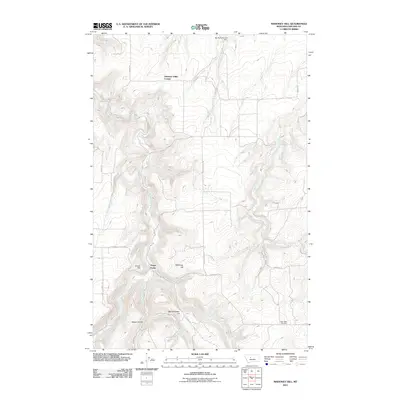
2011 Map of Mahoney Hill
USGS Topo · Published 2011About this map
Pleasant Valley Colony and the small settlement of Three Forks occupy a landscape defined by the complex drainage systems of Sand Coulee Creek and its many branches. This 2011 survey illustrates a region where ranching and agriculture are shaped by the land's elevation changes, ranging from Bayes Coulee in the south to the high points of Mahoney Hill and Forest Hill. The map documents the local infrastructure of Cascade County through named thoroughfares like Centry School Rd and Cottonwood Coulee Rd, which connect remote homesteads to landmarks like the Tiger Butte Cemetery. Water management is central to life here, evidenced by the presence of Big Dumb Bunny Dam on Spring Creek and the long paths of Box Elder Creek and Shellrock Creek.
Find a feature on this map
23 named features on this map. Tap any name to fly to it.
Don’t see what you’re looking for? This feature index may not catch every label — zoom into the map to look around manually.
Map Details
Editions of this 2011 Mahoney Hill Map
This is the sole edition of this map. No revisions or reprints were ever made.
Other maps of this area

1886 · Great Falls
USGS Topo · 1:250,000

1890 · Fort Benton
USGS Topo · 1:250,000

1892 · Fort Benton
USGS Topo · 1:250,000

1897 · Fort Benton
USGS Topo · 1:250,000

1954 · Great Falls
USGS Topo · 1:250,000

1955 · Stockett
USGS Topo · 1:62,500

1956 · Belt
USGS Topo · 1:62,500

1957 · Great Falls
USGS Topo · 1:250,000
1965 · Southeast Great Falls
USGS Topo · 1:24,000
1965 · Fife
USGS Topo · 1:24,000