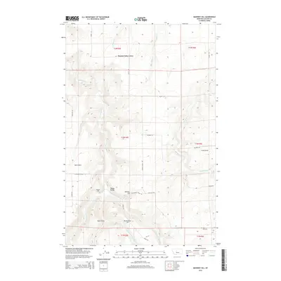
2014 Map of Mahoney Hill
USGS Topo · Published 2014About this map
Pleasant Valley Colony and the agricultural plateaus of Swede Bench and Dutch Bench define this corner of Cascade County. The landscape is deeply incised by the drainage systems of Sand Coulee Cr, Box Elder Cr, and the several forks of the Sand Coulee. Named topographical features such as Mahoney Hill, Forest Hill, and Blankenbaker Hill provide clear landmarks across the high plains terrain. Local family names and community history are preserved in the road network, including Takala Rd, Mundt Rd, and Thorsen Rd. Of particular interest to genealogists and local historians is the Tiger Butte Cem located in the southeastern corner near Tiger Butte, alongside infrastructure indicators like Century School Rd, which points to the area's rural development and educational history.
Find a feature on this map
31 named features on this map. Tap any name to fly to it.
Don’t see what you’re looking for? This feature index may not catch every label — zoom into the map to look around manually.
Map Details
Editions of this 2014 Mahoney Hill Map
This is the sole edition of this map. No revisions or reprints were ever made.
Other maps of this area

1886 · Great Falls
USGS Topo · 1:250,000

1890 · Fort Benton
USGS Topo · 1:250,000

1892 · Fort Benton
USGS Topo · 1:250,000

1897 · Fort Benton
USGS Topo · 1:250,000

1954 · Great Falls
USGS Topo · 1:250,000

1955 · Stockett
USGS Topo · 1:62,500

1956 · Belt
USGS Topo · 1:62,500

1957 · Great Falls
USGS Topo · 1:250,000
1965 · Southeast Great Falls
USGS Topo · 1:24,000
1965 · Fife
USGS Topo · 1:24,000