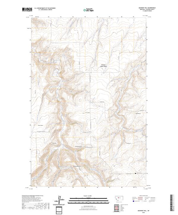
2024 Map of Mahoney Hill
USGS Topo · Published 2024About this map
Mahoney Hill and the surrounding drainage basins of Cascade County define this landscape of high benches and deep coulees. The terrain is characterized by flat-topped elevations like Dutch Bench and Swede Bench, which overlook the winding path of Sand Coulee Creek and its many tributaries, including the Middle Fork and East Fork. These geographical features reflect a classic Montana agricultural layout where level highlands are utilized for farming while the coulees manage the region's intermittent water flow.
Find a feature on this map
30 named features on this map. Tap any name to fly to it.
Don’t see what you’re looking for? This feature index may not catch every label — zoom into the map to look around manually.
Map Details
Editions of this 2024 Mahoney Hill Map
This is the sole edition of this map. No revisions or reprints were ever made.
Other maps of this area

1886 · Great Falls
USGS Topo · 1:250,000

1890 · Fort Benton
USGS Topo · 1:250,000

1892 · Fort Benton
USGS Topo · 1:250,000

1897 · Fort Benton
USGS Topo · 1:250,000

1954 · Great Falls
USGS Topo · 1:250,000

1955 · Stockett
USGS Topo · 1:62,500

1956 · Belt
USGS Topo · 1:62,500

1957 · Great Falls
USGS Topo · 1:250,000
1965 · Southeast Great Falls
USGS Topo · 1:24,000
1965 · Fife
USGS Topo · 1:24,000