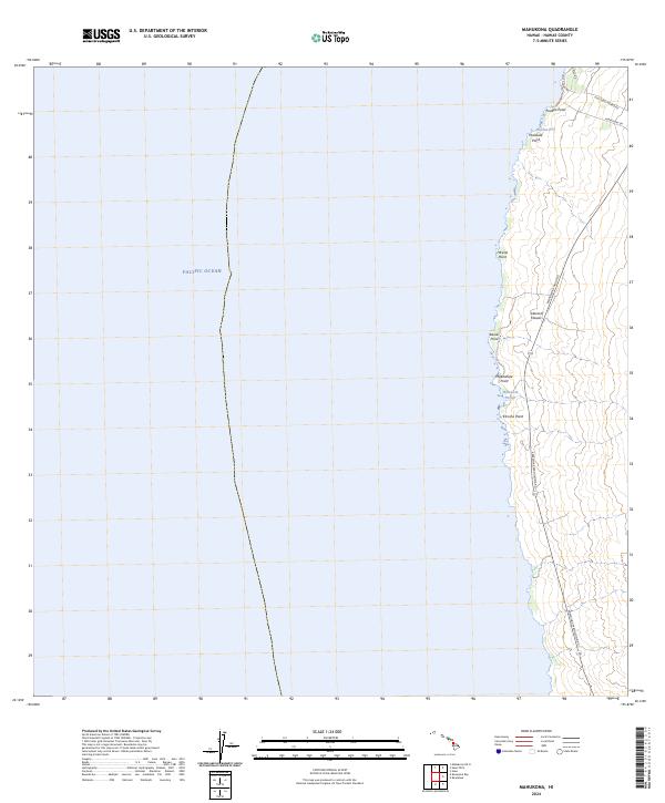
2024 Map of Mahukona
USGS Topo · Published 2024About this map
The northwestern coastline of the Island of Hawai‘i is defined here by a series of prominent volcanic headlands and small inlets. Central to this maritime landscape is Māhukona Harbor, a site that anchors the coastal transport network. The terrain is marked by sharp geographic markers including Puakea Point at the northern reach, and others such as Hā‘ena Point and Kā‘oma Point. Modern transportation routes like the Kawaihae-Mahukona Rd and Mahukona-Niulii Rd trace the contours of the land, providing access to this shoreline. This 2024 survey depicts a landscape where small bays, such as Holana Bay, provide the only breaks in the rocky interface between the Pacific and the upland slopes.
Find a feature on this map
16 named features on this map. Tap any name to fly to it.
Don’t see what you’re looking for? This feature index may not catch every label — zoom into the map to look around manually.
Map Details
Editions of this 2024 Mahukona Map
This is the sole edition of this map. No revisions or reprints were ever made.
Other maps of this area

1913 · Kohala
USGS Topo · 1:62,500

1916 · Kohala
USGS Topo · 1:62,500

1954 · Hawaii North
USGS Topo · 1:250,000

1956 · Kawaihae
USGS Topo · 1:24,000
1957 · Keawanui Bay
USGS Topo · 1:24,000
1957 · Mahukona
USGS Topo · 1:24,000
1957 · Hawi
USGS Topo · 1:24,000

1959 · Hawaii North
USGS Topo · 1:250,000

1961 · Hawaii North
USGS Topo · 1:250,000

1975 · Hawaii
USGS Topo · 1:250,000