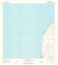
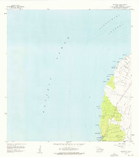
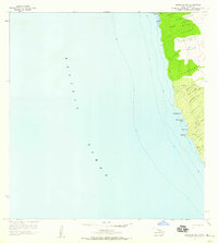
1957 Map of Mahukona
USGS Topo · Published 1978About this map
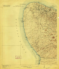
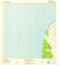
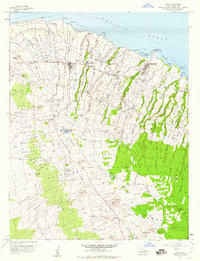
Mookini Heiau and the Kamehameha I Birthplace stand as significant cultural landmarks along the northwestern coast of Hawaii Island, overlooking the Alenuihaha Channel. This mid-century survey documents a coastline defined by ancient history and evolving maritime infrastructure. Further south, Mahukona Harbor serves as a focal point for local transport, supported by a Coast Guard Reservation and its Loran Tower. The transition of the landscape is evident at Honoipu Landing (Site) and Haena (Site), where former activity centers are noted. Inland, the map reveals a system of water management and connectivity, featuring a Pipeline, various water tanks, and a network of Jeep Trails and footpaths that navigate the sloping terrain toward the Pacific Ocean.
Find a feature on this map
48 named features on this map. Tap any name to fly to it.
Don’t see what you’re looking for? This feature index may not catch every label — zoom into the map to look around manually.
Map Details
Editions of this 1957 Mahukona Map
3 editions found
Other maps of this area

1913 · Kohala
USGS Topo · 1:62,500
1916 · Kohala
USGS Topo · 1:62,500

1954 · Hawaii North
USGS Topo · 1:250,000
1957 · Keawanui Bay
USGS Topo · 1:24,000
1957 · Mahukona
USGS Topo · 1:24,000
1957 · Hawi
USGS Topo · 1:24,000

1959 · Hawaii North
USGS Topo · 1:250,000

1961 · Hawaii North
USGS Topo · 1:250,000

1975 · Hawaii
USGS Topo · 1:250,000

1980 · Hawaii County Sheet 1
USGS Topo · 1:100,000