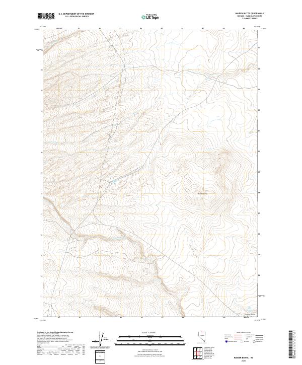
2021 Map of Maiden Butte
USGS Topo · Published 2021About this map
Maiden Butte rises as a prominent landmark within the expansive high-desert terrain of northern Humboldt County. This 2021 survey details an arid landscape defined by its seasonal water sources and intermittent drainages, including the Little Owyhee River and the headwaters of Raven Cr. The presence of Maiden Springs and Twin Valley Springs suggests the critical importance of reliable water in this corner of the Owyhee Desert, where historical grazing and travel would have been dictated by these sparse features. Modern infrastructure is limited to rugged tracks like Quinn River Rd, which navigates the township and range lines through the high plateau. The map provides a clear look at the topography where the high plains meet the intricate drainages of Calico Cr, illustrating the isolation and specialized environment of the Great Basin's northern reaches.
Find a feature on this map
12 named features on this map. Tap any name to fly to it.
Don’t see what you’re looking for? This feature index may not catch every label — zoom into the map to look around manually.
Map Details
Editions of this 2021 Maiden Butte Map
This is the sole edition of this map. No revisions or reprints were ever made.
Other maps of this area

1882 · Paradise
USGS Topo · 1:250,000

1893 · Paradise
USGS Topo · 1:250,000

1955 · McDermitt
USGS Topo · 1:250,000

1959 · McDermitt
USGS Topo · 1:250,000

1980 · Calico Butte
USGS Topo · 1:24,000

1980 · Capitol Peak
USGS Topo · 1:24,000

1980 · Mahogany Spring
USGS Topo · 1:24,000
1980 · Button Lake
USGS Topo · 1:24,000

1980 · Greeley Flat
USGS Topo · 1:24,000
1980 · Maiden Butte
USGS Topo · 1:24,000