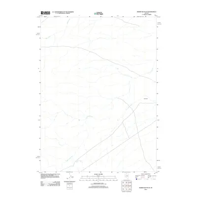
2012 Map of Maiden Butte SE
USGS Topo · Published 2012About this map
The Little Owyhee River winds through this arid sector of Elko County, tracing a course across a landscape defined by intermittent water systems and wide plateaus. This 2012 survey captures a remote portion of the high desert where the human footprint is remarkably sparse, centered primarily on the settlement at Dobe Doc. These few named locations serve as critical navigational markers in a region where geography is more often defined by the drainage patterns of seasonal tributaries like Raven Creek. The map provides a precise look at the hydrology of the basin, illustrating how these creeks feed into the larger river system during the spring runoff, supporting the ranching or grazing activities common to this part of Nevada.
Find a feature on this map
3 named features on this map. Tap any name to fly to it.
Don’t see what you’re looking for? This feature index may not catch every label — zoom into the map to look around manually.
Map Details
Editions of this 2012 Maiden Butte SE Map
This is the sole edition of this map. No revisions or reprints were ever made.
Other maps of this area

1882 · Paradise
USGS Topo · 1:250,000

1893 · Paradise
USGS Topo · 1:250,000

1955 · McDermitt
USGS Topo · 1:250,000

1959 · McDermitt
USGS Topo · 1:250,000

1973 · Star Valley Ridge SW
USGS Topo · 1:24,000

1973 · Button Lake Well
USGS Topo · 1:24,000
1973 · Star Valley Ridge West
USGS Topo · 1:24,000

1980 · Calico Butte
USGS Topo · 1:24,000
1980 · Button Lake
USGS Topo · 1:24,000

1980 · Greeley Flat
USGS Topo · 1:24,000