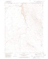
1973 Map of Star Valley Ridge West
USGS Topo · Published 1977About this map
The Little Owyhee River snakes through the high desert borderlands where Nevada and Idaho meet, carving a distinct canyon path beneath Star Valley Ridge. This early 1970s topography highlights a landscape defined by seasonal water management and grazing routes, most notably at the Lake Creek Reservoir and the solitary Cathcart Place near the northern boundary. The terrain rises sharply from the river valley to prominent landmarks such as Indian Buttes and Nadine Butte in the southeast.
Find a feature on this map
14 named features on this map. Tap any name to fly to it.
Don’t see what you’re looking for? This feature index may not catch every label — zoom into the map to look around manually.
Map Details
Editions of this 1973 Star Valley Ridge West Map
This is the sole edition of this map. No revisions or reprints were ever made.
Other maps of this area

1882 · Paradise
USGS Topo · 1:250,000

1893 · Paradise
USGS Topo · 1:250,000

1955 · McDermitt
USGS Topo · 1:250,000

1955 · Jordan Valley
USGS Topo · 1:250,000

1957 · Jordan Valley
USGS Topo · 1:250,000

1958 · Jordan Valley
USGS Topo · 1:250,000

1959 · McDermitt
USGS Topo · 1:250,000

1973 · Coyote Hole
USGS Topo · 1:24,000

1973 · Star Valley Ridge SW
USGS Topo · 1:24,000
1973 · Star Valley Ridge East
USGS Topo · 1:24,000