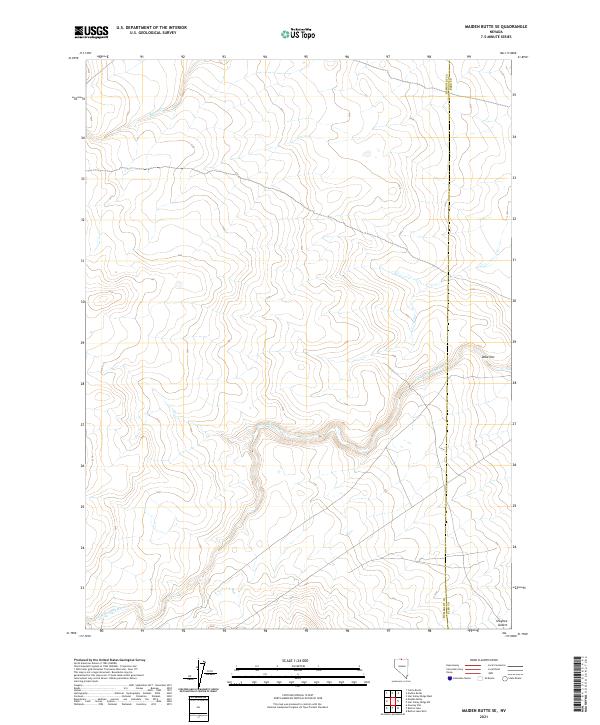
2021 Map of Maiden Butte SE
USGS Topo · Published 2021About this map
The Little Owyhee River snakes across this high desert landscape, marking the transition from the Owyhee Desert into the broken terrain of northern Nevada. This 2021 study by the U.S. Geological Survey documents the sparse drainage network of the Great Basin, where Raven Cr and other ephemeral waters define the topography. The eastern boundary is defined by the line between Humboldt Co and Elko Co, slicing through a region characterized by section lines and vast grazing allotments. Named landmarks like Dobe Doc provide specific points of reference in an otherwise expansive and open landscape, reflecting the traditional nomenclature used by ranchers and land managers in this corner of Nevada.
Find a feature on this map
10 named features on this map. Tap any name to fly to it.
Don’t see what you’re looking for? This feature index may not catch every label — zoom into the map to look around manually.
Map Details
Editions of this 2021 Maiden Butte SE Map
This is the sole edition of this map. No revisions or reprints were ever made.
Other maps of this area

1882 · Paradise
USGS Topo · 1:250,000

1893 · Paradise
USGS Topo · 1:250,000

1955 · McDermitt
USGS Topo · 1:250,000

1959 · McDermitt
USGS Topo · 1:250,000

1973 · Star Valley Ridge SW
USGS Topo · 1:24,000

1973 · Button Lake Well
USGS Topo · 1:24,000
1973 · Star Valley Ridge West
USGS Topo · 1:24,000

1980 · Calico Butte
USGS Topo · 1:24,000
1980 · Button Lake
USGS Topo · 1:24,000

1980 · Greeley Flat
USGS Topo · 1:24,000