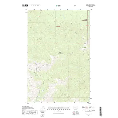
2020 Map of Maiden Peak
USGS Topo · Published 2020About this map
Hurricane Ridge and Elk Mtn define the high country in this high-altitude survey of Clallam County. Located within the Olympic National Park, the area is characterized by a dense network of backcountry routes, including the Obstruction Point-Deer Park Trail and Badger Valley Trail. These paths connect a series of glacial basins, such as Badger Valley and Grand Valley, which hold remote water bodies like Maiden Lake, Moose Lake, and Gladys Lake.
Find a feature on this map
40 named features on this map. Tap any name to fly to it.
Don’t see what you’re looking for? This feature index may not catch every label — zoom into the map to look around manually.
Map Details
Editions of this 2020 Maiden Peak Map
This is the sole edition of this map. No revisions or reprints were ever made.
Other maps of this area

1918 · Port Angeles
USGS Topo · 1:62,500

1938 · Mt Constance
USGS Topo · 1:125,000

1938 · Dungeness
USGS Topo · 1:62,500

1939 · Dungeness
USGS Topo · 1:62,500

1941 · Port Angeles
USGS Topo · 1:62,500

1944 · Mt. Angeles
USGS Topo · 1:62,500

1946 · Mt. Angeles
USGS Topo · 1:62,500

1946 · Tyler Peak
USGS Topo · 1:62,500

1948 · Tyler Peak
USGS Topo · 1:62,500
1950 · Port Angeles
USGS Topo · 1:24,000