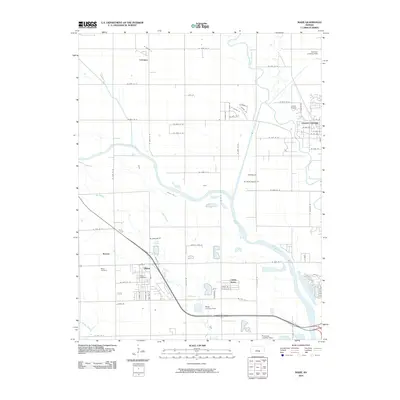
2010 Map of Maize
USGS Topo · Published 2010About this map
The Arkansas River and its accompanying waterways, Big Slough and Little Slough, dictate the landscape of this region north of Wichita. The city of Maize serves as a central hub, containing vital local landmarks including the Maize Post Office and the Maize Cemetery. This area exhibits a distinct aviation character, evidenced by a high density of private airstrips and small airfields such as Harrison Landing Field, Luther Airport, and Maize Landing Field. To the northeast, the outskirts of Valley Center appear, while smaller residential clusters like Childs Acres and Berwet are situated along the grid of country roads. The Little Arkansas River meanders through the northeast corner, further defining the drainage patterns that have influenced local settlement and the placement of communities like Coleman.
Find a feature on this map
63 named features on this map. Tap any name to fly to it.
Don’t see what you’re looking for? This feature index may not catch every label — zoom into the map to look around manually.
Map Details
Editions of this 2010 Maize Map
This is the sole edition of this map. No revisions or reprints were ever made.
Other maps of this area

1889 · Cheney
USGS Topo · 1:125,000

1889 · Wichita
USGS Topo · 1:125,000

1891 · Cheney
USGS Topo · 1:125,000

1894 · Wichita
USGS Topo · 1:125,000

1901 · Cheney
USGS Topo · 1:125,000

1941 · Maize
USGS Topo · 1:31,680

1941 · Valley Center
USGS Topo · 1:31,680

1942 · Valley Center
USGS Topo · 1:31,680

1942 · Maize
USGS Topo · 1:31,680

1943 · Wichita West
USGS Topo · 1:31,680