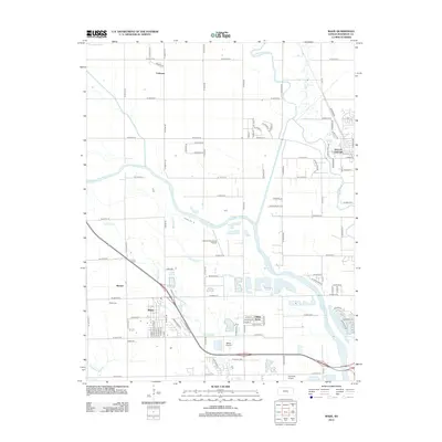
2012 Map of Maize
USGS Topo · Published 2012About this map
Maize and Valley Center anchor this northwest Wichita-area landscape, where the prairie grid is increasingly shaped by suburban expansion and transportation corridors. The Arkansas River and Little Arkansas River converge toward the southeast, leaving a complex drainage network of secondary channels like Big Slough and Little Slough. This hydrological pattern historically defined the usable land between the settlements of Coleman and Berwet.
Find a feature on this map
92 named features on this map. Tap any name to fly to it.
Don’t see what you’re looking for? This feature index may not catch every label — zoom into the map to look around manually.
Map Details
Editions of this 2012 Maize Map
This is the sole edition of this map. No revisions or reprints were ever made.
Other maps of this area

1889 · Cheney
USGS Topo · 1:125,000

1889 · Wichita
USGS Topo · 1:125,000

1891 · Cheney
USGS Topo · 1:125,000

1894 · Wichita
USGS Topo · 1:125,000

1901 · Cheney
USGS Topo · 1:125,000

1941 · Maize
USGS Topo · 1:31,680

1941 · Valley Center
USGS Topo · 1:31,680

1942 · Valley Center
USGS Topo · 1:31,680

1942 · Maize
USGS Topo · 1:31,680

1943 · Wichita West
USGS Topo · 1:31,680