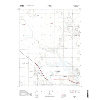
2018 Map of Maize
USGS Topo · Published 2018About this map
Maize and the northern outskirts of Wichita define this 2018 topographic survey, showing a landscape defined by the convergence of the Arkansas River and the Little Arkansas River. The modern development of the region is evident in the transition from the gridded streets of Valley Center to the recreational corridors of the Maize Bike Path. Significant landmarks such as Maize Airport and the Maize Cem anchor the community's local history and infrastructure. The natural hydrology of the region is highly visible, with the Big Slough and Little Slough weaving through the agricultural and residential boundaries of Childs Acres and Berwet. This survey captures the suburban expansion of Sedgwick County, where major drainage features like Cowskin Cr and Wilson Lake interface with an increasingly dense network of section-line roads and residential plats.
Find a feature on this map
36 named features on this map. Tap any name to fly to it.
Don’t see what you’re looking for? This feature index may not catch every label — zoom into the map to look around manually.
Map Details
Editions of this 2018 Maize Map
This is the sole edition of this map. No revisions or reprints were ever made.
Other maps of this area

1889 · Cheney
USGS Topo · 1:125,000

1889 · Wichita
USGS Topo · 1:125,000

1891 · Cheney
USGS Topo · 1:125,000

1894 · Wichita
USGS Topo · 1:125,000

1901 · Cheney
USGS Topo · 1:125,000

1941 · Maize
USGS Topo · 1:31,680

1941 · Valley Center
USGS Topo · 1:31,680

1942 · Valley Center
USGS Topo · 1:31,680

1942 · Maize
USGS Topo · 1:31,680

1943 · Wichita West
USGS Topo · 1:31,680