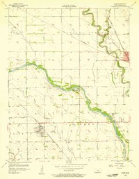
1956 Map of Maize
USGS Topo · Published 1957About this map
The Little Arkansas River meanders through the heart of Sedgwick County, defining a landscape shaped by both water and rail at the height of the 1950s. The town of Maize sits along the Missouri Pacific line, centered near the Maize Cem and the surrounding agricultural tracts. To the northeast, the community of Valley Center serves as a significant junction where the St Louis San Francisco and Atchison Topeka and Santa Fe railroads converge, marking the area's importance to regional transport. Evidence of industrial activity is scattered across the sheet, from the Oil Wells in the east to multiple Sandpits following the river's course. Low-lying areas are managed by an extensive Aqueduct system and a series of protective Levee structures, while the Indian Boundary line persists as a historical marker across the modern township divisions.
Find a feature on this map
30 named features on this map. Tap any name to fly to it.
Don’t see what you’re looking for? This feature index may not catch every label — zoom into the map to look around manually.
Map Details
Editions of this 1956 Maize Map
This is the sole edition of this map. No revisions or reprints were ever made.
Other maps of this area

1889 · Cheney
USGS Topo · 1:125,000

1889 · Wichita
USGS Topo · 1:125,000

1891 · Cheney
USGS Topo · 1:125,000

1894 · Wichita
USGS Topo · 1:125,000

1901 · Cheney
USGS Topo · 1:125,000

1941 · Maize
USGS Topo · 1:31,680

1941 · Valley Center
USGS Topo · 1:31,680

1942 · Valley Center
USGS Topo · 1:31,680

1942 · Maize
USGS Topo · 1:31,680

1943 · Wichita West
USGS Topo · 1:31,680