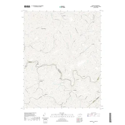
2019 Map of Majestic
USGS Topo · Published 2019About this map
Tug Fork carves a deep path through this section of the Central Appalachian coalfields, serving as the natural boundary between West Virginia and Kentucky. The map documents a landscape defined by narrow hollows and steep ridges, where settlements like Vulcan, Devon, and Stopover are tightly bound to the riverbanks and creek bottoms. This 2019 survey shows the continued industrial presence of Thacker Mines in the north and the localized infrastructure of the Norfolk Southern railway corridor following the river. Local genealogy is anchored by several small burial sites, including the Steele Cem and Simkins Family Cem, which remain tucked into the side valleys. The intricate network of small streams, such as Beech Cr and Mate Cr, illustrates the complex drainage patterns that have historically dictated the placement of roads and homesteads throughout Mingo and Pike counties.
Find a feature on this map
102 named features on this map. Tap any name to fly to it.
Don’t see what you’re looking for? This feature index may not catch every label — zoom into the map to look around manually.
Map Details
Editions of this 2019 Majestic Map
This is the sole edition of this map. No revisions or reprints were ever made.
Other maps of this area

1886 · Grundy
USGS Topo · 1:125,000

1887 · Warfield
USGS Topo · 1:125,000

1890 · Grundy
USGS Topo · 1:125,000

1891 · Tazewell
USGS Topo · 1:125,000

1891 · Oceana
USGS Topo · 1:125,000

1891 · Warfield
USGS Topo · 1:125,000

1892 · Grundy
USGS Topo · 1:125,000

1893 · Oceana
USGS Topo · 1:125,000

1895 · Tazewell
USGS Topo · 1:125,000

1897 · Tazewell
USGS Topo · 1:125,000