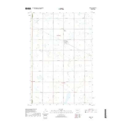
2018 Map of Makoti
USGS Topo · Published 2018About this map
The town of Makoti serves as the focal point for this rural landscape on the border of Mountrail and Ward counties. This agricultural area is defined by a grid of local section roads, including County Highway 9 and County Highway 22, which link together scattered prairie farms. North of the town center, the Saint Elizabeth Catholic Cem stands as a significant landmark for genealogical research and local history. The terrain is dotted with numerous small wetlands and basins typical of the North Dakota prairie, illustrating the complex drainage patterns of the region's topography. The survey reflects the enduring structure of the township and range system, with t152n r87w and neighboring sections meticulously demarcated for modern administrative and land-use tracking.
Find a feature on this map
25 named features on this map. Tap any name to fly to it.
Don’t see what you’re looking for? This feature index may not catch every label — zoom into the map to look around manually.
Map Details
Editions of this 2018 Makoti Map
This is the sole edition of this map. No revisions or reprints were ever made.
Other maps of this area

1954 · Minot
USGS Topo · 1:250,000

1954 · McClusky
USGS Topo · 1:250,000

1956 · Makoti SW
USGS Topo · 1:24,000

1956 · Blue Hill
USGS Topo · 1:24,000

1956 · Roseglen
USGS Topo · 1:24,000

1958 · McClusky
USGS Topo · 1:250,000

1958 · Minot
USGS Topo · 1:250,000

1980 · Minot
USGS Topo · 1:100,000

1980 · Plaza SE
USGS Topo · 1:24,000

1980 · Makoti
USGS Topo · 1:24,000