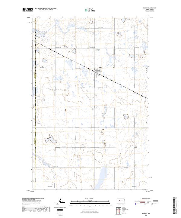
2024 Map of Makoti
USGS Topo · Published 2024About this map
Makoti serves as the central hub of this prairie landscape, where the grid of the Missouri Plateau meets the western edge of Ward County Waterfowl Production Area. The town’s orderly streets, including 3rd Ave W and 2nd Ave W, are surrounded by a vast network of section roads like Co Hwy 9 and 261st Ave SW. This area preserves several distinct burial grounds that speak to the community's heritage, including Saint Elizabeth Catholic Cem to the north and Hope Lutheran Cem on the eastern outskirts. Farther south, Saint Pauls Lutheran Cem stands alone along 317th Ave SW. The terrain is defined by numerous prairie potholes and wetlands, protected within multiple units of the waterfowl production area, reflecting the region's importance to migratory bird populations.
Find a feature on this map
32 named features on this map. Tap any name to fly to it.
Don’t see what you’re looking for? This feature index may not catch every label — zoom into the map to look around manually.
Map Details
Editions of this 2024 Makoti Map
This is the sole edition of this map. No revisions or reprints were ever made.
Other maps of this area

1954 · Minot
USGS Topo · 1:250,000

1954 · McClusky
USGS Topo · 1:250,000

1956 · Makoti SW
USGS Topo · 1:24,000

1956 · Blue Hill
USGS Topo · 1:24,000

1956 · Roseglen
USGS Topo · 1:24,000

1958 · McClusky
USGS Topo · 1:250,000

1958 · Minot
USGS Topo · 1:250,000

1980 · Minot
USGS Topo · 1:100,000

1980 · Plaza SE
USGS Topo · 1:24,000

1980 · Makoti
USGS Topo · 1:24,000